 TERRASIGNA (former ASRC) conducted a study using the potential of the Differential Synthetic Aperture Radar Interferometry (DInSAR) technique to monitor landslides.
DInSAR is a remote sensing technique used to detect ground displacements up to millimeters accuracy. It can be used to monitor various sites like urban, glaciers, volcanoes, earthquake deformation, and landslides. The advantage of DInSAR over other methods is the continuous coverage of the measurements area. This particularity of the technique is useful to detect ground motion without a priori knowledge of a site, thus it also serves as an indication for the optimum installation of conventional monitoring tools (GPS, levelling) if needed.
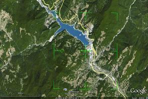
Taking into consideration the requests of the Romanian Environment Ministry, the monitored site was Siriu water dam (Buzau County, Romania). During recent years, several landslides affecting the water dam and the surroundings had been reported in the area. The water dam construction triggered slopes instability that led to one major landslide blocking the lake in 2006 and other landslides affecting the main road and the water dam infrastructure also.
The study had started in September 2009. The preliminary results revealed the huge potential of the method. With DInSAR a number of unstable sites were detected. It was shown that the major landslide is still active, the road is moving in two main regions due to the slopes activities and the water dam infrastructure is also affected by yet another slope movement.
TERRASIGNA collaborated with the Geography Institute of the Romanian Academy in conducting the study.
Two TerraSAR-X High Resolution Spotlight images at 11 days temporal distance (September – October 2009), kindly supplied by Infoterra GmbH, Germany, have been used in the study.
Please contact us if this subject is of interest for your organisation.