 During the training session of the Geospace project at the beginning of February 2012, the TERRASIGNA (former ASRC) experts introduced to the participants the 4.0 version of LEOWorks, as one of the interactive teaching instruments for Geography and Geomatics promoted by the project.
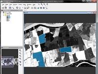
LEOWorks (LEO = Learning with Earth Observation) is an Image processing/Geographic Information System (GIS) software for educational purposes developed by TERRASIGNA (former ASRC) within the European Space Agency (ESA) Plan for European Cooperating State (2008 – 2011). Version 3.0 of the application is published on the ESA’s educational website Eduspace and it is already used in European schools and universities for inspection and analyzing satellite images.
The re-engineered LEOWorks 4.0 is more flexible and easier to use for both students and teachers, as new features were developed:
- Modular design allowing easy development of new functionalities and tools as plug-ins/modules, and linking to external libraries;
- Read common satellite data formats (ENVISAT, SPOT, Landsat, etc.) as well as generic digital image formats (geotiff, jpg, bmp, etc.);
- Basic GIS and new optical and SAR image processing tools added on top of the existing components developed in ESA’s BEAM and NEST projects;
- Application-specific image processing algorithms for detecting e.g. urban areas, oil spills, ships.