 The Land Surface Temperature (LST) is an important climatic factor that influences the urban environment and therefore the quality of live within these urban settlements. The LST is determined mainly by the air temperature and is directly related to the land cover / land use type.
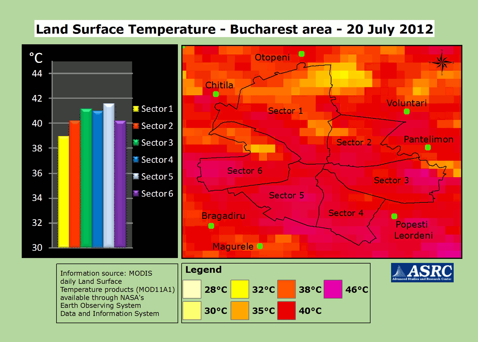
TERRASIGNA (former ASRC) experts have analyzed the daily LST products (day time) available from NASA’s Earth Observing Data and Information System. They were computed from the data acquired by the MODIS sensor on board Terra platform. Information refered to the urban area of Bucharest for the time period 20 July - 15 August 2012. The data series was not continuous due to the presence of clouds.
A difference in temperature could be observed between the Southern areas (in sector 5 were registered the highest temperatures) and the Northern areas. This difference is determined mainly by the presence of the forested areas (Baneasa, Chitila) and the water bodies (lakes Pantelimon, Fundeni, Plumbuita, Tei, Floreasca, Herastrau, Straulesti, Mogosoaia, Morii) in or nearby sectors 1, 2 and partially 6, while sectors 3, 4 and 5 are heavily covered by buildings, with limited green areas.
As provider of monitoring services, TERRASIGNA has a wide experience in satellite images processing and can deliver to decision makers customized solutions for environmental monitoring.