 TERRASIGNA (former ASRC) had released a report on Polarimetric Synthetic Aperture Radar (PolSAR), analyzing a dataset acquired at L band by the ALOS / PALSAR system over a particularly complex region, the Danube Delta.
This was part of a greater study on the Danube Delta conducted by the company. It was the first study ever conducted using SAR (Synthetic Aperture Radar) in the Danube Delta that has revealed extremely useful, complex and new information about ground deformation.
Both difficult access and the special status of the Danube Delta Biosphere Reservation asked for non-intrusive monitoring methods. Vegetation cover, as well as weather conditions in the region made optical surveillance a difficult task. Radar or, more precisely, SAR observation was the natural alternative.
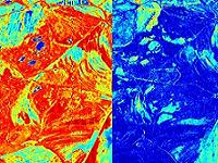
Polarimetry beared some information about the scatterers when applied to remote sensing: the delay and the frequency of the backscattered wave, as well as the amplitude of the received echo. This information can be exploited under different paradigms.
Acquisition at different polarizations of the electromagnetic wave was one of the methods aiming to increasing the input data in order to achieve a more detailed description of the scatterer.
Several methods for exploiting PolSAR data have been presented in this report.
1. Basic polarimetric representations:
- lexicografic decomposition - completely ignores the relative phases of the polarimetric channels and it is of limited use;
- Pauli decomposition - also takes into account the relative phases of the polarimetric channels. It thus allows distinguishing between several elementary mechanisms such as odd- and even-bounce reflexion.
2. Advanced polarimetric representations
- H/α/A decomposition - based on the eigenanalysis of the coherency matrix of the PolSAR image;
- TSVM (Target Scattering Vector Model) decomposition is an alternative model for physical characterization of scattering surfaces in PolSAR imaging. It may be applied for both mono-static and bi-static configurations.
Generally, results showed exploitable potential for surface characterization.
For more information on report’s conclusions and TERRASIGNA competencies in monitoring ground deformation using Polarimetric Synthetic Aperture Radar techniques, please contact us.